Burnt Island
Burnt Island
The fog begins to break in the early morning. The harbor is calm though with little wind and plenty of ducks swimming by the shore. As the little motor boat navigates between the colored buoys, I watch the growing red light coming from my destination.
Burnt Island is a small island just off the coast of Boothbay Harbor. Its name came from the slash and burn tactics to support its sheep farmers. No sheep currently reside there; in fact, the island has been home to only its lighthouse keepers for over two hundred years. However, many governmental employees and visitors will park their boat at the singular dock for a quick visit to the lighthouse and Department of Marine Resources’ little educational facility, and for such a small island, I was surprised at how much there was to see.
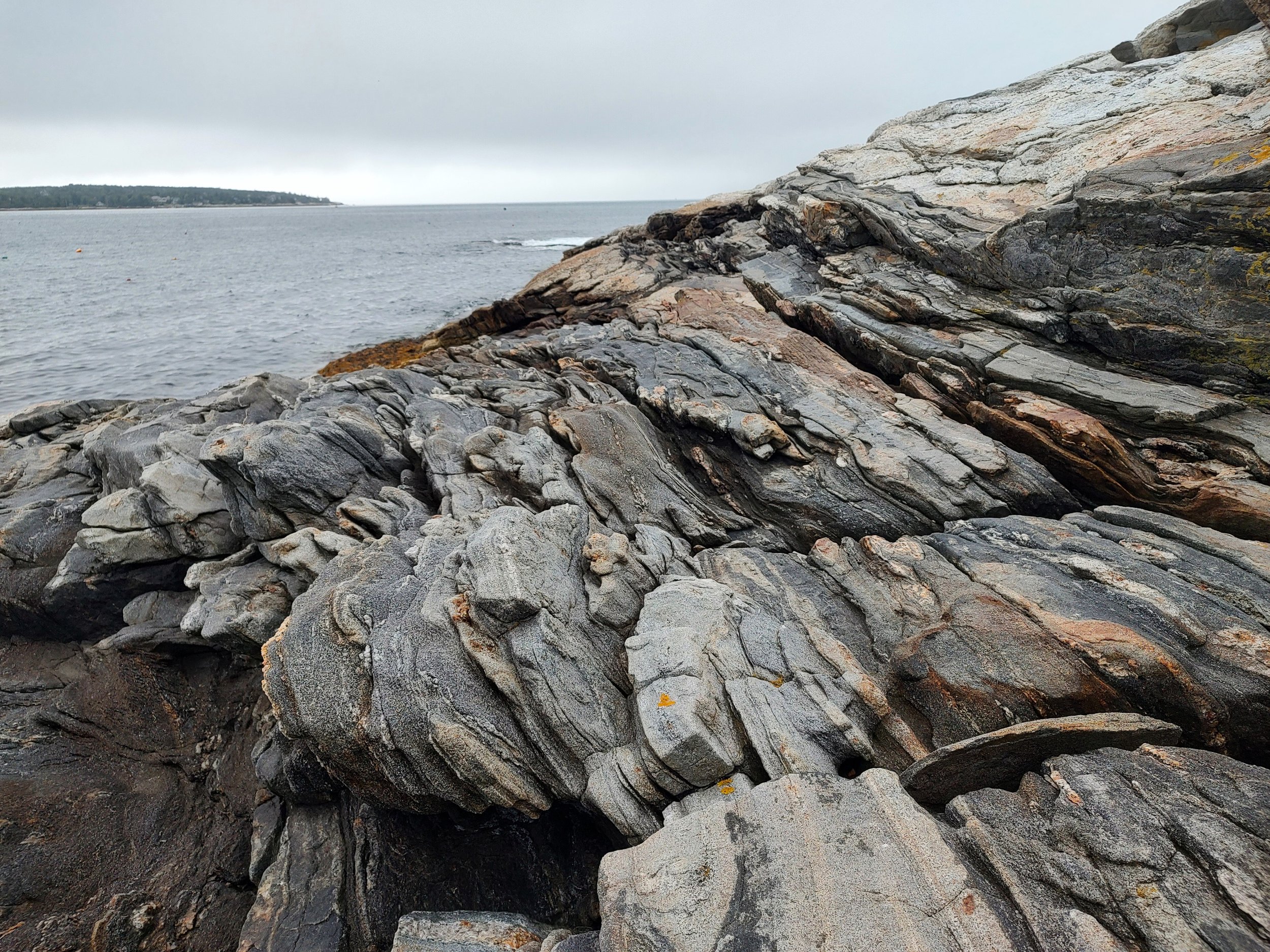
It started with the rocks. As I hopped, climbed, and crawled across the island’s shore, I noticed the rocks had a distinct pattern. The large striations cut the rocks like wedges, leaving them nearly vertical in some places. I later learned that the rocks were once ocean sediment hundreds of millions of years ago. As the Earth’s landscape changed, the rocks were laid flat by thousands of years under the sea. They were buried deeper until the heat and pressure transformed them into how they look today.
Walking up the boarded path from the beach leads to a brick building no bigger than a small shed. This was the oil house. For many years, the lighthouse used whale oil to fuel the light, but in the late 1800s, the keepers found a more efficient and volatile fuel source: kerosene. The oil house was constructed as a fireproof building, complete with a slate roof and lightning rod to contain the kerosene oil. Despite the island’s name, there were no tragic fires.
Around the same time, a bell was constructed at the top of the light house. When the fog rolled in, the keeper would crank a weighted mechanism inside the lighthouse that would cause the bell to chime twice a minute. When electricity came to the island, the bell was moved to the base of the lighthouse and eventually replaced by an automatic foghorn.
The most curious part of the island was the red light that emanated from the lighthouse. Why was it red? The tour guide shared the history of the light, including its color change in 1889. There are two other islands nearby Burnt Island with their own lighthouses. As one can imagine, this could be very confusing to a sailor in low visibility as lights were shined from multiple directions and might cause them to sail into a rocky shore to avoid one source of light. To counteract this confusion, a “dead angle” was installed to prevent the light from being shone westward past the dangerous rocks. Using a series of clever tricks throughout the years, the Burnt Island lighthouse and its neighboring islands were able to shine their lights in a way that directed sea-goers to safe harbor. One such trick was to make Burnt Island’s light red. This color change introduced an extra level of clarity, allowing an added sense of direction to an obfuscated path.
The fog slowly burned off over the course of my visit. The coastal breeze remained calm and on the boat ride back to the mainland, I saw the dorsal fin of a porpoise crest the waves. I said goodbye to Burnt Island and the red light that signaled its shores.


